Chhattisgarh Hill Stations: Mainpat, Chaiturgarh and Jashpur
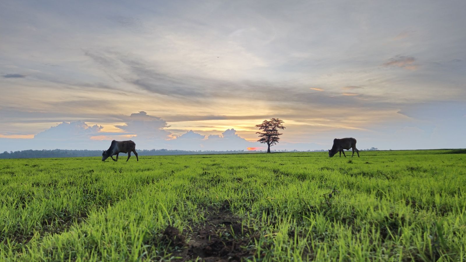
Photo: Xtra Click, CC BY 4.0 (cropped), via Wikimedia Commons

Morning mist lifting off the fields and sal forest of the Mainpat plateau, high above Ambikapur in northern Chhattisgarh.
Chhattisgarh has no Shimla, but its plateaus and hill forts keep a cooler, quieter kind of high ground.
Mainpat, the one hill retreat
Most of the places that older lists call Chhattisgarh's hill stations are cities on the plain: Raipur, Durg, Bilaspur and Korba are hot, busy and flat. The state's real high ground lies on its edges, on plateaus the people of the north call pat, meaning a flat-topped upland. The best known is Mainpat in Surguja district, about 28 km long and about 1,085 m high, which is often called the Shimla of Chhattisgarh.
It is a farming plateau rather than a resort town. Tibetan refugees were settled here in 1962 and 1963, and their seven camps, where woollens and carpets are made, give parts of it a look of the Himalaya. Visitors come for the viewpoints and odd corners the district lists: Tiger Point and Fish Point, where streams fall off the edge; Ultapani, where water seems to run uphill; and Jaljali, a patch of spongy ground that wobbles underfoot. The Rihand and Mand rivers both rise on the plateau.
Getting to Mainpat
Ambikapur, the divisional town, is the base. The state's public relations department gives Mainpat as about 55 km from it; the district's own page gives 75 km, which depends on the road taken. Ambikapur has a railway station, and its small airport at Darima began flights to Delhi and Kolkata, via Bilaspur, in the spring of 2026; check the current schedule before you plan around them. Raipur, the state capital, is about 350 km away by road, and there are buses and trains from Raipur to Ambikapur, so it makes sense to break the journey in Ambikapur and go up the next morning.
Chaiturgarh and the Korba hills
Chaiturgarh, also called Lafagarh, is a fort that nature built. It stands on a hill in Korba district at about 930 m (the district gives 3,060 feet), around 25 km north of Pali and 70 km from Korba. Sheer cliffs serve as walls, and three gateways lead onto a level top with ponds and a temple to Mahishasurmardini, the goddess as slayer of the buffalo demon. There is a rest house on top. The nearest railway stations are Korba and Bilaspur, each about 50 to 55 km away.
Jashpur and the road to Bastar
In the north-east, Jashpur district climbs from a lower plain to the Upper Ghat, a plateau of about 1,200 m reached by the Loroghat road. It is a region of sal forest and waterfalls such as Rani Dah, about 12 km from Jashpur town. The nearest airport is Ranchi, in Jharkhand, about 150 km away. Further west, Samri Pat in Balrampur district holds Gaurlata, at about 1,225 m long called the state's highest peak.
In the south, the road from Raipur to Jagdalpur climbs the Keshkal ghat in Kondagaon district, twelve hairpin bends through forest, with the Tatamari plateau above it. Jagdalpur sits on the Bastar plateau at about 550 m: not a hill station, but the base for Chitrakote falls and Kanger Valley National Park.
Which is the highest point?
For years, books and websites have named Gaurlata, at about 1,225 m on Samri Pat in Balrampur district, as the highest point in Chhattisgarh. In 2025 a team of geographers reported that Nandiraj peak, in the Bailadila hills of Dantewada district in the south, is higher, at about 1,276 m. Bailadila is better known for its iron-ore mines than for walking, and the question has not been settled in any official list, so treat both figures as approximate.
Either way, the high ground lies at the state's northern and southern ends. The middle is the wide rice plain of the Mahanadi, which is why the cooler places are a long drive from Raipur.
Hill stations to know
- Mainpat (Surguja, altitude about 1,085 m): Chhattisgarh's coolest easy escape, with Tibetan settlements and viewpoints.
- Tiger Point and Fish Point (Surguja): waterfalls on the rim of the Mainpat plateau, fullest after the rains.
- Chaiturgarh (Korba, altitude about 930 m): a cliff-walled hill fort with a goddess temple on top.
- Jashpur Upper Ghat (Jashpur, altitude about 1,200 m): forested plateau, tribal villages and waterfalls.
- Samri Pat (Balrampur, altitude about 1,225 m at Gaurlata): remote high ground on the Jharkhand side.
- Keshkal Ghat and Tatamari (Kondagaon): a forest ghat road and a plateau viewpoint on the way to Bastar.
- Jagdalpur (Bastar, altitude about 550 m): a plateau town and base for falls and caves.
- Amarkantak (Anuppur, Madhya Pradesh): the source of the Narmada, just over the border and often wrongly listed here.
Chhattisgarh's high ground is quiet, forested and a little cooler, and on a winter morning on Mainpat that is enough.
Plan your visit
| Best season | October to February, cool and clear; nights on Mainpat can be cold in December and January. July to September for waterfalls, though roads are slow. March to June is hot, even on the plateaus. |
|---|---|
| How to reach | Ambikapur (railway station, and Darima airport with flights from spring 2026; check the schedule) for Mainpat. Korba or Bilaspur station for Chaiturgarh, via Pali. Raipur airport and station for Keshkal and Bastar. Ranchi, about 150 km, for Jashpur. |
| Getting around | A car with a driver from Ambikapur, Bilaspur or Raipur. Many viewpoints are off the main roads, and buses are slow. |
| Safety | No permits are needed. Kanger Valley National Park reopened on 1 October 2026 after its monsoon closure. Parts of south Bastar are affected by Maoist insurgency; keep to main routes there and take local advice. |
| Where to stay | Mainpat or Ambikapur; Pali or Korba for Chaiturgarh; Jashpur town for the Upper Ghat; Kondagaon or Jagdalpur for Keshkal and Bastar. |
| How long to spend | Two nights for Mainpat; a day for Chaiturgarh; two days for Jashpur; Keshkal as a stop on the way to Bastar. More in our Chhattisgarh guide. |
Questions people ask
Why is Mainpat called the Shimla of Chhattisgarh?
Because it is the coolest high ground most people in the state can easily reach. It has no colonial town or mall road; it is a farming plateau with Tibetan camps, viewpoints and simple hotels.
What is Jaljali on Mainpat?
A patch of soft, water-filled ground that quivers when people jump on it, listed by the district with Ultapani, where a stream appears to flow uphill.
Is Amarkantak in Chhattisgarh?
No. It is in Anuppur district of Madhya Pradesh, just over the border, though it is easy to combine with a trip from Bilaspur. For Pachmarhi, the classic hill station of central India, see our Madhya Pradesh guide.
Read next
Written by Muthu, editor of Aura of India. Sources: Surguja Division: Mainpat, District Surguja: Places of interest, Directorate of Public Relations, Chhattisgarh: Mainpat, District Korba: Chaiturgarh, Chhattisgarh Tourism Board: Jashpur, District Kondagaon: Keshkal Valley, UK Foreign Office: India travel advice, regional risks. Last verified: 15 October 2026.
Your turn: Have you stayed on Mainpat? Did the ground at Jaljali really move under your feet?
Comments
Post a Comment
Comments are always welcome, that will help us to motivate ourselves and improve our services. Thanks!!