Andhra Pradesh Along Its Rivers: Godavari, Krishna and the Coast
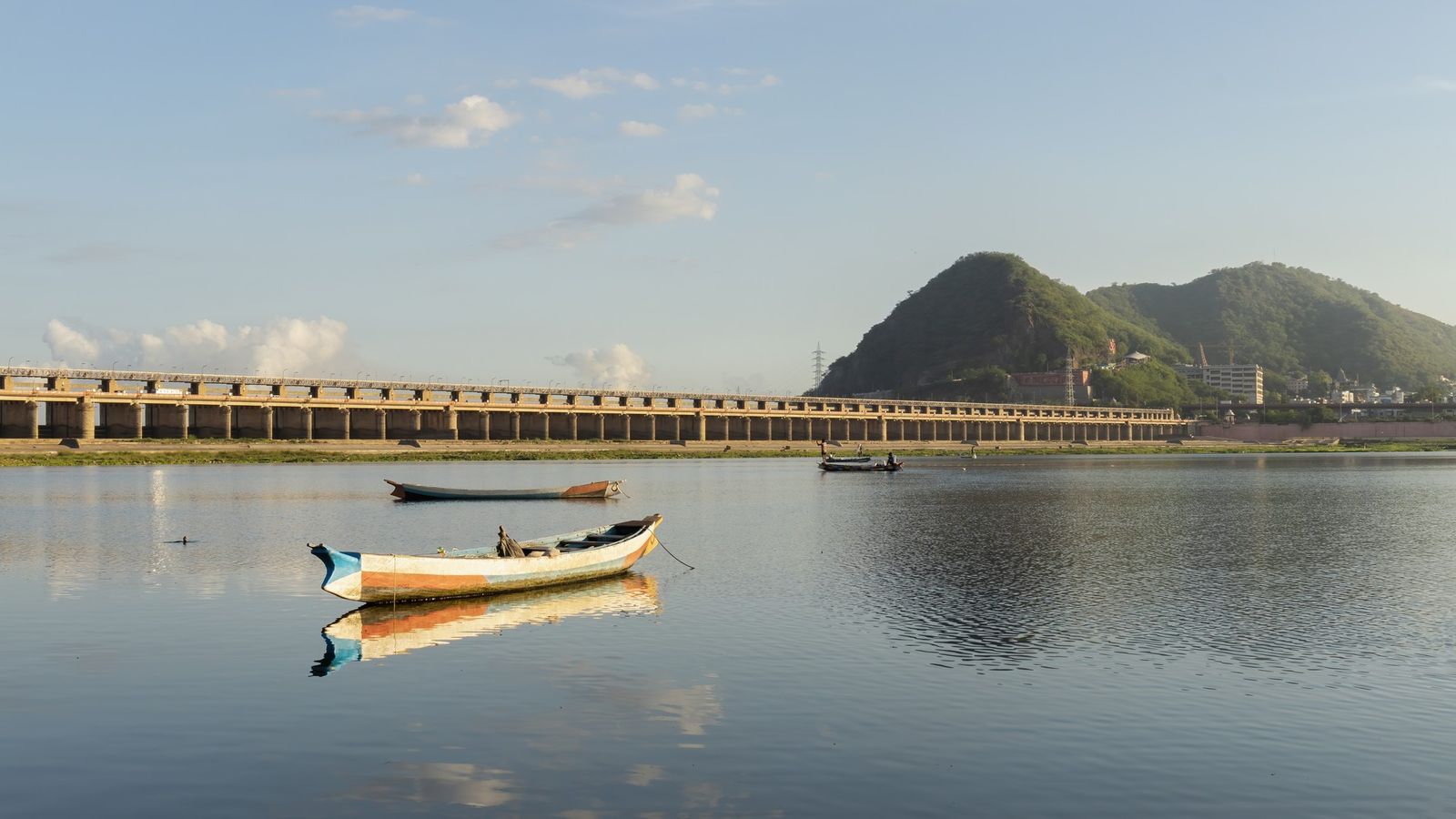
Photo: iMahesh, CC BY-SA 4.0 (cropped), via Wikimedia Commons

Andhra Pradesh in late October, as the Godavari settles after the floods.
Two great rivers cross Andhra to one long coast, and most of the state lives along the way.
Rivers, coast and dry hills
Andhra Pradesh runs down India’s east coast for 974 km, the second-longest coastline of any state. Two rivers cross it from the west. The Godavari and the Krishna both rise far away in the Western Ghats, and here they slow down, split into channels and build deltas of rice fields, canals and coconut palms before they reach the Bay of Bengal. Behind the coast stand the Eastern Ghats, low and forested. To the south-west the land dries out into Rayalaseema, a plateau of red earth and granite boulders.
One thing to settle early: Telangana is a separate state. It was carved out on 2 June 2014, and Hyderabad went with it. Andhra’s food, temples and coast are its own.
Life on the banks
Much of the state still works by its rivers. In October the paddy in the deltas stands green and heavy, and the canals that feed it run full. At Rajamahendravaram, the old river city most people still call Rajahmundry, the Godavari is so wide that its bridges run for kilometres. People come down the ghats, the stepped banks, to bathe and pray at first light. The city is getting ready for the Godavari Pushkaralu, a river festival held once in twelve years, set for 26 June to 7 July 2027.
Upstream, the river narrows into a gorge between the Papikondalu hills. Tourist boats run into it from the Gandi Pochamma temple jetty, now in the new Polavaram district, and they started again on 13 October 2026 after about seventy days of floodwater. Down on the coast, fishing villages push their boats out before dawn.
Why people come
Andhra’s past is layered along the Krishna. More than two thousand years ago a great Buddhist stupa, a domed monument holding relics, stood at Amaravati, and its carved limestone panels are among the finest early sculpture in India. Much later the Vijayanagara kings built and endowed temples across the south of the state, from Lepakshi, with its painted ceilings and hanging pillar, to the hill shrine at Tirumala, which now draws tens of thousands of pilgrims a day.
The state is also new in some ways. It has had 28 districts since Markapuram and Polavaram were created on 31 December 2025. Its capital, Amaravati, is being built beside the Krishna near Vijayawada, and Parliament named it in the Andhra Pradesh Reorganisation (Amendment) Act 2026. The new city borrows its name from the old Buddhist town upstream.
Getting there and around
Distances are long, so choose a region. Visakhapatnam’s flights moved on 17 August 2026 to the new Alluri Sitarama Raju International Airport at Bhogapuram, north of the city. Vijayawada, Tirupati and Rajahmundry have airports too. The main coastal railway links Visakhapatnam, Rajahmundry and Vijayawada, and it is the easiest way to travel along the coast. State buses, run by APSRTC, reach almost every town. For temples and villages off the main roads, hire a car with a driver.
Three regions, three trips
The north coast is Visakhapatnam and the hills behind it. Give the city two days, then take the train up into the Araku valley; see Araku.
The Godavari country is the delta between Rajamahendravaram and Kakinada: rice fields, canal roads, coconut groves and the long boat trip into the Papikondalu gorge. Konaseema, the land between the river’s branches, is best seen slowly, by road.
The south is the Krishna and Rayalaseema. Vijayawada and the Amaravati stupa sit close together on the Krishna; Tirupati is a night’s train away; Lepakshi is easier to reach from Bengaluru than from most of Andhra. For every story from the state, see the Andhra Pradesh guide.
Names on the map
Many places have two names. Rajahmundry is officially Rajamahendravaram, and Visakhapatnam is Vizag in conversation; tickets and bus boards may use either.
Amaravati is two places. The capital city is being built near Vijayawada; the Buddhist site, with its stupa mound and museum, is the old town of the same name further up the Krishna. Maps printed before 31 December 2025 also show 26 districts, not 28, and some boundaries have moved.
Places to know
- Visakhapatnam: a port city on a bay, with hills at its back.
- Araku valley: coffee and hill country in the Eastern Ghats, reached by train from Visakhapatnam.
- Rajamahendravaram: river ghats on the Godavari, and the road to the Papikondalu boats.
- Vijayawada: the Krishna’s main city, with the Prakasam Barrage and the Kanaka Durga temple on its hill.
- Amaravati: the old stupa site and its archaeological museum, closed on Fridays.
- Tirupati and Tirumala: the temple town and the hill shrine above it.
- Lepakshi and Gandikota: a Vijayanagara temple and a river gorge in dry Rayalaseema.
On the Godavari at dusk, a ferry crosses slowly, and the far bank takes a long time to arrive.
Plan your visit
| Best season | October to March. October can still bring showers and high rivers, and the coast can see cyclones from October to December. April to June is very hot inland. |
|---|---|
| How to reach | Fly to Visakhapatnam (Bhogapuram), Vijayawada, Tirupati or Rajahmundry. The main coastal railway links Visakhapatnam, Rajahmundry and Vijayawada with Kolkata and Chennai. |
| Getting around | Trains along the coast; APSRTC buses between towns; a car with a driver for temples, the delta villages and Rayalaseema. |
| Where to stay | Beach Road in Visakhapatnam; the riverside in Rajamahendravaram; central Vijayawada near the railway station; Tirupati for Tirumala. |
| How long to spend | Three or four days for one region; ten days to two weeks for the north coast, the Godavari and the south together. |
| Papikondalu boats | From the Gandi Pochamma jetty at Devipatnam, Polavaram district. Boats restarted on 13 October 2026 after the floods and stop whenever the river rises: check before you go. Fares: check when booking. |
Questions people ask
What is the capital of Andhra Pradesh?
Amaravati. The Andhra Pradesh Reorganisation (Amendment) Act 2026, published on 6 April 2026, names it the capital, with effect from 2 June 2024.
How many districts does Andhra Pradesh have?
Twenty-eight. Markapuram and Polavaram districts came into force on 31 December 2025, raising the number from 26.
Is Hyderabad in Andhra Pradesh?
No. Hyderabad is in Telangana, which became a separate state on 2 June 2014.
Are the Papikondalu boat trips running?
Yes. They resumed on 13 October 2026 after about seventy days of floods. Services stop when the Godavari rises, so check on the day.
Read next
Written by Muthu, editor of Aura of India. Sources: Gazette of India: The Andhra Pradesh Reorganisation (Amendment) Act, 2026, The Hindu: Two new districts, Polavaram and Markapuram, come into force, Government of Andhra Pradesh: AP Tourism Policy 2024–2029 (PDF), East Godavari district: Godavari Pushkaralu 2027, The Hindu: Bhogapuram airport takes over Visakhapatnam’s flights, Deccan Chronicle: Government permits tourism boat services to Papikondalu, Amaravati capital city (official): tourism and the Amaravati stupa. Last verified: 15 October 2026.
Your turn: Which river town would you go back to: Rajamahendravaram on the Godavari or Vijayawada on the Krishna, and why?
Comments
Post a Comment
Comments are always welcome, that will help us to motivate ourselves and improve our services. Thanks!!