Rockfort Temple, Trichy: Climb, View and How to Visit
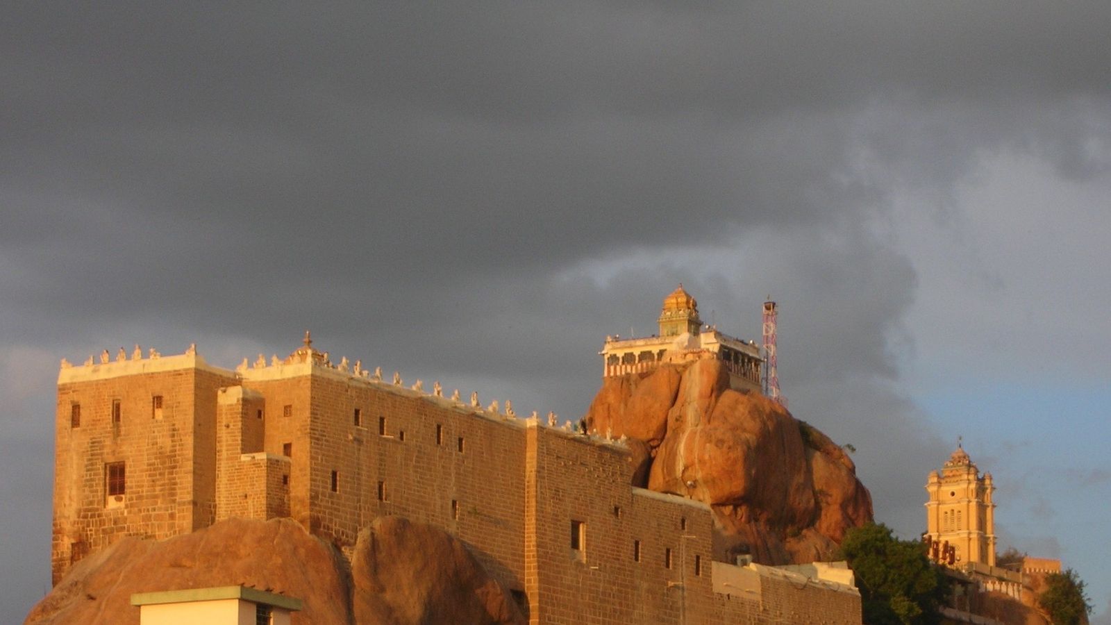
Photo: Vijayshinde107, CC BY-SA 4.0 (cropped), via Wikimedia Commons

The Rockfort above Tiruchirappalli, early morning before the stone holds the heat.
Trichy does not hide its temple on a hill. The hill is the temple, and the city grew under its shadow.
The climb you see first
The Rockfort, or Malaikottai, rises about 83 metres from the old town. The Tiruchirappalli district page counts 437 rock-cut steps to the Ucchi Pillayar shrine at the summit. Lower stretches run through covered passages. Higher up the steps open to sun and wind. Halfway, the Thayumanaswamy temple to Shiva sits in the rock with pillared halls. At the top, a small Ganesha shrine looks out over the Cauvery, the Coleroon branch, and the gopurams of Srirangam on the island to the north. Leave footwear at the base as directed. The stone can burn bare feet by late morning.
How devotees and visitors use it
People climb for darshan, for exercise, and for the view. Morning and late afternoon are cooler. The midday sun on the open steps is hard. There is no lift. Carry a little water, rest on the landings, and keep to the right when others pass. Dress with shoulders and knees covered. Photography rules tighten near the sanctums; follow the signs. Festival days such as Vinayaka Chaturthi and Karthigai Deepam draw long queues; regional calendars can shift a festival by a day. Plan two hours if you want both shrines and time at the summit rail.
Why the rock holds the town
The outcrop is ancient granite. Cave shrines and inscriptions reach far back, and later rulers fortified the hill. The twin rivers below made Trichy a hinge between the Chola country and the south. From the top you see why: water, temple towers, and the flat town pressed close to the rock. This is not Thanjavur’s great vimana and not Madurai’s corridor city. It is one climb, one skyline, and a clear look at the Cauvery system.
How to reach the steps
Tiruchirappalli International Airport is about 10 km away. Trichy Junction is the main rail station. The Rockfort entrance sits in the NSB Road bazaar area, roughly 1 km from Chatram bus stand and about 5 km from the central bus stand. Autos drop you near the foot; cars cannot wait in the narrow lanes. Start the climb early, then walk or ride toward the river if you want a ghat view of the same water you saw from above.
Reading the view from the summit
From the Ucchi Pillayar rail you look north toward Srirangam’s towers and the split of the Cauvery and Coleroon. The old town presses close below the rock. Give yourself ten quiet minutes at the top after darshan; that is the point of the climb.
Srirangam and Thiruvanaikaval are separate temple visits for another half-day. This post stays on the Rockfort. For the wider state, see the Tamil Nadu guide.
Heat, feet and festivals
Footwear is left at the base, so the open upper steps can scorch after mid-morning. Dawn and late afternoon are kinder. Carry a little water and rest on the covered landings.
Vinayaka Chaturthi and Karthigai Deepam draw heavy crowds. Festival dates on regional calendars can shift by a day—check locally before you go.
Before you climb
- Steps: about 437 to the summit; no wheelchair access.
- Timings: temples often open around dawn and again after a midday break; check at the gate.
- Entry: generally free; small charges may apply for footwear or cameras.
- Dress: modest clothes; head coverings where posted.
- Heat: avoid noon in summer; the open upper steps have little shade.
- View: Srirangam and the rivers are clearest after rain or in winter light.
At the summit rail the Cauvery is a dull silver band, and the rock underfoot still holds the cool of dawn.
Plan your visit
| Entry | Generally free; small charges may apply for footwear or cameras—check at the gate. |
|---|---|
| Opening hours | Shrines commonly open from about 6 am, with a midday break at some sanctums; confirm timings at the entrance on the day. |
| Best time | October to February for cooler climbing; on any day, go early morning or late afternoon. |
| How to reach | Airport about 10 km; Trichy Junction by rail; Rockfort about 1 km from Chatram bus stand, about 5 km from the central bus stand. |
| Dress and rules | Cover shoulders and knees; follow photography signs near sanctums; no lift on the climb. |
| Time needed | About one and a half to two hours for the climb, shrines and summit view. |
| Nearest stay areas | Near Trichy Junction or the central bus-stand belt for easy autos to the Rockfort. |
Open Rockfort Temple, Tiruchirappalli, Tamil Nadu in Google Maps
Questions people ask
How many steps are there at Trichy Rockfort?
The Tiruchirappalli district administration gives 437 rock-cut steps to the summit shrine. Take rests on the way; there is no lift.
Is there an entry fee?
Entry is generally free. You may pay small amounts for footwear storage or camera use—check at the gate.
Can you see Srirangam from the top?
Yes. On a clear day the gopurams of Srirangam and the river branches are part of the summit view.
What is the best time of day to climb?
Early morning or late afternoon. The open upper steps are hard in the midday sun, especially in summer.
Is the climb suitable for everyone?
It is steep and not wheelchair accessible. Anyone who cannot manage many steps should stay at the base shrines.
Read next
Written by Muthu, editor of Aura of India. Sources: Tiruchirappalli District: RockFort Temple, Tamil Nadu Tourism, Archaeological Survey of India. Last verified: 22 October 2026.
Your turn: Did you climb Rockfort at dawn or for the evening light, and how clear was Srirangam from the summit?
Comments
Post a Comment
Comments are always welcome, that will help us to motivate ourselves and improve our services. Thanks!!