Karnataka Hill Stations: Coorg, Chikkamagaluru, Kodachadri
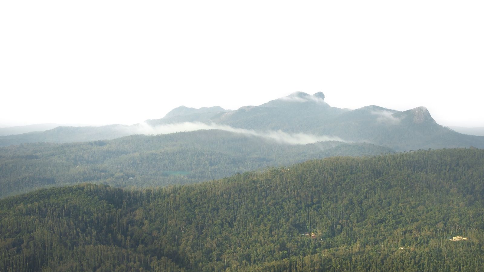
Photo: iMahesh, CC BY-SA 4.0 (cropped), via Wikimedia Commons

The Baba Budangiri hills above Chikkamagaluru, Karnataka, as the cloud clears after the monsoon.
Karnataka's hill stations are coffee country first: the towns are small, and the estates, grasslands and forest do the rest.
Kodagu, or Coorg
Kodagu, still widely called Coorg, is a whole hill district rather than a single resort. Its main town, Madikeri, sits on a ridge of the Western Ghats, and around it run coffee and pepper estates under tall shade trees. This is the home of the Kodava people, with their own dress, food and festivals, and of the river Kaveri, which rises at Talakaveri. Many visitors stay on estates and eat pandi curry, a dark, sour pork dish. Our story on Coorg spends longer under the shade trees.
No railway reaches Kodagu; most people drive up from Bengaluru, Mysuru or Mangaluru. The district gets very heavy rain from June to September, and landslides have closed its ghat roads in some years.
Chikkamagaluru and the Baba Budangiri range
Chikkamagaluru is where Indian coffee is said to have begun, and its hills are still covered in estates. Above the town rises Mullayanagiri, at about 1,930 m the highest peak in Karnataka, with a small shrine at the summit and a short climb on foot at the end. Since September 2025 every vehicle going up to Mullayanagiri, Seethalayyanagiri, the Baba Budangiri shrine and the falls nearby must book a slot online in advance.
Kemmangundi, about 55 km north of the town at about 1,434 m, was the summer camp of Krishnaraja Wadiyar IV, the Mysuru king, who gave it to the state. Its gardens are kept by the horticulture department, a path leads to Z Point above the grasslands, and the sunset is watched from the old Raj Bhavan. Kudremukh, to the south-west, is a national park of rolling grassland; its trek must be booked on the forest department's portal.
The Malnad: Sakleshpur, Agumbe and Kodachadri
The Malnad is the rainy hill country along the Western Ghats, and it holds Karnataka's quieter hill places. Sakleshpur, in Hassan district, is a coffee and cardamom town on the main road from Bengaluru to Mangaluru, with estate stays all around. Agumbe, in Shivamogga district at about 826 m, is a village rather than a resort, known as one of the wettest places in south India, for its sunsets over the forest and for the king cobras studied at its rainforest research station.
Kodachadri, at about 1,343 m, rises above the temple town of Kollur. The last stretch is by jeep or on foot, and its forest trails are booked on the same state portal as Kudremukh.
Near Bengaluru and Mysuru: Nandi Hills and BR Hills
Nandi Hills, in Chikkaballapur district about 60 km from Bengaluru, is the city's sunrise hill: a fortified summit with old temples and views over the plain. The gates open at 6 am, and weekends are crowded. BR Hills, the Biligiri Ranganatha hills of Chamarajanagar district, rise to about 5,091 feet above the dry country south-east of Mysuru. A hilltop temple stands at the edge of a tiger reserve, and jeep safaris leave from the forest camp at K Gudi.
Booking ahead in the Chikkamagaluru hills
The road from Chikkamagaluru to Mullayanagiri is too narrow for two-way traffic in places. Since 1 September 2025 the district allows at most 1,200 vehicles a day on the Chandra Drona hills, in two slots: 6 am to noon and 1 pm to 6 pm. Each slot has a quota for cars, taxis, tempo travellers and two-wheelers, including guests going to homestays on the hill. Mini buses are not allowed.
Book on the district's online toll portal with your vehicle number, and keep the receipt on your phone. At the time of writing the fee was ₹100 for a car and ₹50 for a two-wheeler; check before you go. Weekend slots sell out first.
Hill stations to know
- Madikeri (Kodagu): the main town of coffee-growing Coorg.
- Mullayanagiri (Chikkamagaluru, altitude about 1,930 m): Karnataka's highest peak; book the vehicle slot first.
- Kemmangundi (Chikkamagaluru, altitude about 1,434 m): a king's summer camp, gardens and the walk to Z Point.
- Kudremukh (Chikkamagaluru): grassland and shola forest, trek by permit only.
- Sakleshpur (Hassan): coffee and cardamom estates on the road to the coast.
- Agumbe (Shivamogga, altitude about 826 m): rainforest, rain and sunsets.
- Kodachadri (Shivamogga, altitude about 1,343 m): a forest summit above Kollur.
- Nandi Hills (Chikkaballapur): sunrise above the plain, an hour or two from Bengaluru.
- BR Hills (Chamarajanagar): a temple hill in a tiger reserve.
In Karnataka's hills the smell of drying coffee arrives before the view does.
Plan your visit
| Best season | October to February for clear views and cool days. The monsoon, June to September, is very wet across the Western Ghats; some treks close, and Kodagu's ghat roads can be blocked by landslides. Nandi Hills and BR Hills are drier and can be visited most of the year. |
|---|---|
| How to reach | Bengaluru airport for Nandi Hills, Chikkamagaluru, Sakleshpur and Kodagu. Mangaluru airport for Agumbe, Kodachadri and Kudremukh. Kundapura, on the Konkan Railway, is the nearest station for Kodachadri; Kodagu has no railway. |
| Getting around | A car with driver is easiest. Hired four-wheel-drive jeeps from Kollur and the villages below cover the rough last stretch to Kodachadri. |
| Permits | Online vehicle slot for Mullayanagiri and the Baba Budangiri hills. Kudremukh and Kodachadri treks on the forest department's Aranya Vihaara site, up to 30 days ahead; carry the original identity card you booked with. Jeep safaris at BR Hills are booked through the state's Jungle Lodges. |
| Where to stay | Estate homestays around Madikeri and Chikkamagaluru; Sakleshpur town; Kollur for Kodachadri; Agumbe village; forest lodges at K Gudi for BR Hills. |
| How long to spend | Three or four nights for Coorg, two or three for Chikkamagaluru and Kemmangundi, one each for Agumbe and Kodachadri. Nandi Hills is a morning from Bengaluru. More in our Karnataka guide. |
Open Mullayanagiri, Chikkamagaluru, Karnataka in Google Maps
Questions people ask
Coorg or Chikkamagaluru?
Coorg is larger, with a distinct Kodava culture and food and more homestays. Chikkamagaluru is closer to Karnataka's highest hills and suits people who want viewpoints and treks. Both are coffee country, and both are wettest from June to September.
Is Agumbe worth it outside the monsoon?
Yes, for the forest, the sunset point and the quiet. In the monsoon it is one of the wettest places in south India. Rooms are few, so book ahead.
Can I camp at Kudremukh or BR Hills?
Not on your own. Both are protected areas: Kudremukh treks are by permit only, and at BR Hills visitors stay in the lodges and go out on the forest department's safaris.
Read next
Written by Muthu, editor of Aura of India. Sources: Chikkamagaluru District: Mullayanagiri Hill, Chikkamagaluru District: Tourism (Kemmangundi), The Hindu: Tourists visiting hill stations in Chikkamagaluru need to book online in advance, Karnataka Forest Department: Aranya Vihaara trek booking, Karnataka Tourism: Kodachadri Hills, Karnataka Tourism: Kemmanagundi, Karnataka Tourism: Nandi Hills, Jungle Lodges and Resorts: Kemmanagundi Hill Resort. Last verified: 15 October 2026.
Your turn: Which coffee estate or homestay did you stay at, and was the Mullayanagiri slot easy to book?
Comments
Post a Comment
Comments are always welcome, that will help us to motivate ourselves and improve our services. Thanks!!