Cities in Meghalaya: Shillong, Tura, Jowai and Sohra to Visit
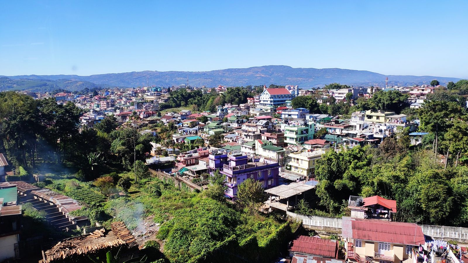
Photo: ANKAN, CC BY-SA 4.0 (cropped), via Wikimedia Commons

Shillong spread over its pine hills, seen from above the city on a clear winter afternoon.
Shillong takes most of the visitors, but each of Meghalaya's three hill countries has a town of its own.
Shillong, a city of several towns
Shillong is the capital and by far the biggest town in Meghalaya. The 2011 Census counted 143,229 people inside its municipal boundary, but the city a visitor sees is larger. Mawlai, Nongthymmai, Madanriting and Pynthorumkhrah were counted as separate towns, and together they held almost 150,000 more. It has the widest choice of rooms and hired cars, so most trips start here.
No railway reaches Shillong. The usual way in is the road from Guwahati, about 100 km, and the small airport at Umroi, outside the city, has only a handful of flights.
Sohra and Jowai, a day from the capital
Sohra, also called Cherrapunji, is a small town on the southern edge of the plateau. It is the base for the waterfalls and for the long flight of steps down to Nongriat.
Jowai is the main town of the Jaintia Hills, 60 km east of Shillong on the national highway, with 28,430 people in 2011. Shared Sumos, the jeeps that serve as hill taxis, and buses leave from the Mawlong Hat parking area in Shillong. Just outside the town, Syntu Ksiar on the Myntdu river has a memorial to Kiang Nongbah, the best-known Jaintia freedom fighter. At Nartiang, 24 km away, stands the largest group of monoliths in the Khasi and Jaintia Hills: menhirs, or upright stones, and dolmens, or flat stones, raised by a lieutenant of the Jaintia king and by village clans between about 1500 and 1835.
Tura and the Garo Hills
Tura is Meghalaya's second town, with 74,858 people in 2011, and the main town of the Garo Hills in the west. It is far from Shillong. The district gives 323 km by road, on a route that runs through Guwahati, which is itself only 220 km from Tura. So treat the Garo Hills as a separate trip from Guwahati, not a day out from the capital. Nokrek National Park lies in the hills near the town.
The other Garo towns are smaller and spread out. Williamnagar, headquarters of East Garo Hills, is 76 km from Tura on the Simsang river. Baghmara, in South Garo Hills, is the nearest district town to the Siju caves and to Balpakram; Siju is 134 km from Tura by road. Resubelpara, headquarters of North Garo Hills, is 6 km from Mendipathar, the only railway station in Meghalaya, with passenger trains to Guwahati.
Nongpoh, Nongstoin and the roads in
Nongpoh, headquarters of Ri-Bhoi, is the first district town on the road up from Guwahati, near Umiam Lake, and most people pass straight through. Ri-Bhoi is also where the state plans a facilitation centre at Umling, on the Assam border, to register people entering Meghalaya. As of October 2026 it is not in force: the government expects it to open late in 2026, and changes to the law behind it still await central approval.
To the west, Nongstoin, headquarters of West Khasi Hills, had 28,742 people in 2011 and looks over a quieter, rolling plateau that few visitors reach. Indian nationals need no permit for Meghalaya. Foreign nationals register on arrival, and some border areas may call for a permit.
The Garo Hills from Guwahati
Most of the Garo Hills is closer to Guwahati than to Shillong, so plan it from there. The road to Tura is 220 km on NH 217 through the Assam plains, and shared Sumos and buses run it. Mendipathar station, 6 km from Resubelpara, has passenger trains to and from Guwahati; check the timetable, as there are only a few.
A five-day loop: Guwahati to Tura, two nights there for the town and Nokrek, then a long day across to Williamnagar and Baghmara for Siju, and back to Guwahati. Interior roads get much worse during and just after the monsoon, so go between October and April. For a district-by-district view, see Meghalaya, from the Khasi Hills to the Garo Hills.
Towns to know
- Shillong (East Khasi Hills): 143,229 people in the municipal area in the 2011 Census; the base for most trips.
- Sohra (East Khasi Hills): a plateau-edge town for the waterfalls and the walk to Nongriat.
- Jowai (West Jaintia Hills): 28,430 in 2011; Syntu Ksiar close by and Nartiang 24 km away.
- Tura (West Garo Hills): the second town, 74,858 in 2011; 220 km from Guwahati.
- Williamnagar (East Garo Hills): on the Simsang river, 76 km from Tura.
- Baghmara (South Garo Hills): the nearest district town for Siju and Balpakram.
- Resubelpara (North Garo Hills): 6 km from Mendipathar, the state's only railway station.
- Nongpoh (Ri-Bhoi): the first district town on the Guwahati road.
- Nongstoin (West Khasi Hills): the town of the quiet western plateau.
Shillong is where Meghalaya begins for most people; the other towns are where it goes on.
Plan your visit
| Best season | October to April, for dry roads and clear views. The heaviest rain falls from June to September, when roads in the Garo Hills and on the southern edge of the plateau can be cut. |
|---|---|
| How to reach | Guwahati is the gateway: about 100 km to Shillong, 60 km more to Jowai, and 220 km west to Tura. Shillong's airport at Umroi has a few flights. Mendipathar, in North Garo Hills, is the state's only railway station. |
| Getting around | Shared Sumos and buses between towns; Jowai services leave from Mawlong Hat in Shillong. Hire a car with a driver for Sohra, Nartiang and the Garo Hills parks. |
| Where to stay | Police Bazar or Laitumkhrah in Shillong; Sohra town for the plateau edge; Jowai, along the entry road near Thadlaskein Lake; Tura town for the Garo Hills. |
| How long to spend | Four or five days for Shillong, Sohra and Jowai; another four or five for Tura and the Garo towns, starting from Guwahati. More in the Meghalaya guide. |
| Permits | None for Indian nationals, as of October 2026. Foreign nationals: registration on arrival, and a permit for some border areas. A facilitation centre at Umling, on the Guwahati road, is planned to register people entering the state but is not yet in force; check before you go. |
Questions people ask
Which is the second-largest town in Meghalaya?
Tura, in West Garo Hills, with 74,858 people in the 2011 Census. It is 220 km from Guwahati and 323 km from Shillong by road.
Does Meghalaya rank its towns by development?
No. The state publishes census and town data, but no ranking of towns by development, so this guide does not rank them. Shillong is simply the largest and best served.
What is the Umling facilitation centre?
A centre the state plans on the Assam border in Ri-Bhoi, to register people entering Meghalaya under a state safety law. In October 2026 it was not yet working; the government expected it to open late in the year. Check the latest news before you travel.
Read next
Written by Muthu, editor of Aura of India. Sources: Urban Affairs Department, Meghalaya: town data (Census 2011), West Garo Hills District: How to reach (Tura distances), North Garo Hills District: How to reach (Mendipathar), West Jaintia Hills District: How to reach, West Jaintia Hills District: Nartiang Monoliths, Meghalaya Tourism: Jowai, Meghalaya Tourism: Nartiang Megalith, The Shillong Times: Umling facilitation centre expected by November (16 September 2026). Last verified: 15 October 2026.
Your turn: Have you made the trip to Tura and the Garo Hills? Did you go from Guwahati or from Shillong?
Comments
Post a Comment
Comments are always welcome, that will help us to motivate ourselves and improve our services. Thanks!!