Meghalaya Travel by District: Shillong, Sohra, Dawki, Garo Hills
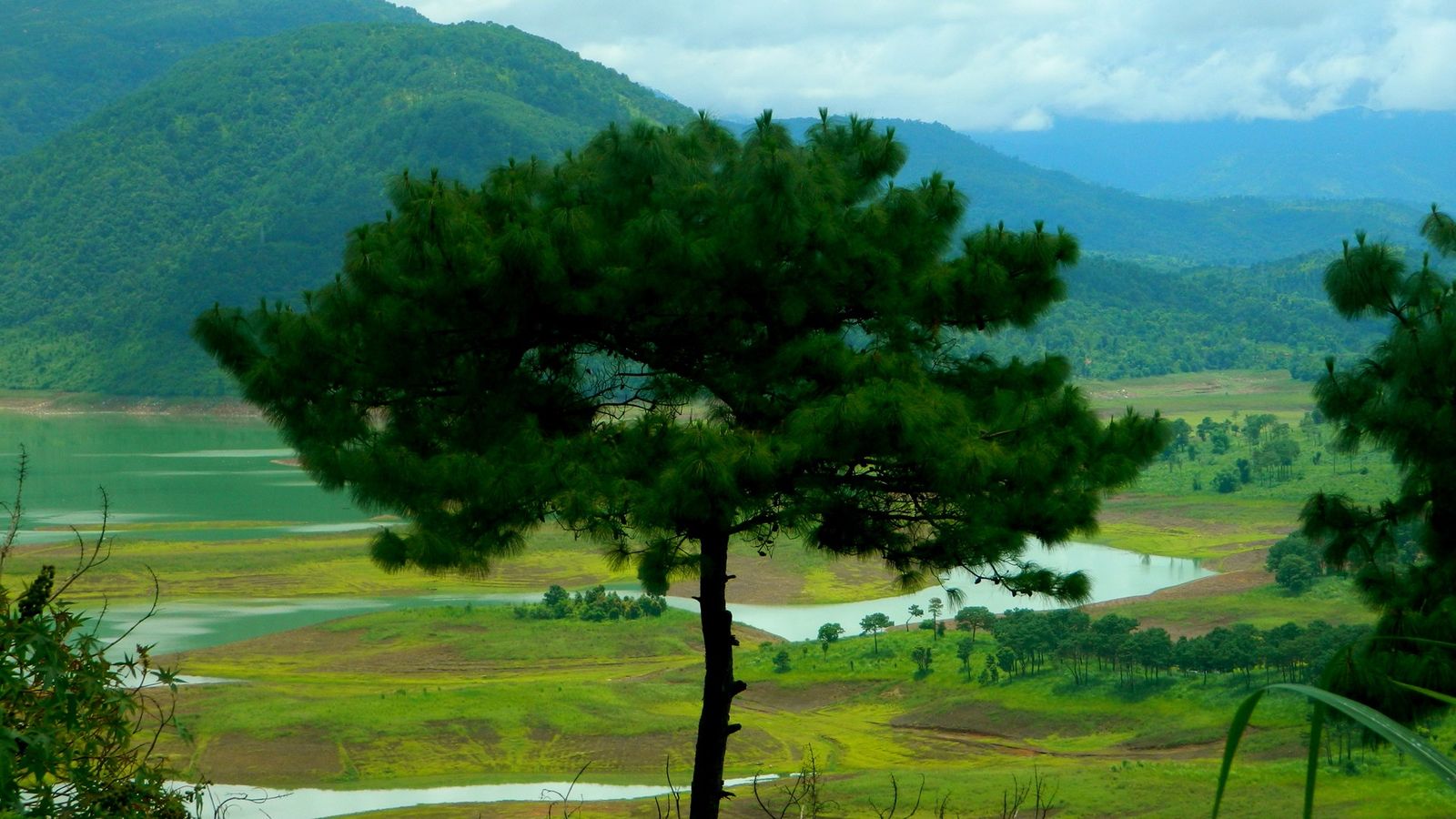
Photo: sangeeta1975, CC BY 2.0 (cropped), via Wikimedia Commons

The Khasi Hills of Meghalaya, as the morning cloud lifts off the valleys.
Meghalaya means "the abode of clouds", and on most days the name is simply a weather report.
Three hill regions
Meghalaya is a small state of green plateaus and deep gorges, set between Assam and Bangladesh. It falls into three hill regions, each named after the people who live there: the Khasi Hills in the centre, the Jaintia Hills to the east, and the Garo Hills to the west. Its dozen districts follow these regions. Shillong, the capital, sits in East Khasi Hills, a hill town of pine trees, churches, music and small cafés.
Rain and root bridges
South of Shillong, the plateau drops sharply towards the plains of Bangladesh, and the clouds break against it. Sohra, also known as Cherrapunji, and nearby Mawsynram are among the wettest places on Earth. In the villages below, Khasi people have trained the roots of rubber trees across streams for generations, making living root bridges; the double-decker bridge near Nongriat is reached by a long flight of steps. In West Jaintia Hills, the Umngot river at Dawki is so clear that boats seem to float in air.
The Garo Hills
The western districts are quieter and less visited. Tura is the main town of the Garo Hills, and Nokrek National Park, above it, protects wild citrus trees and forests where elephants move. Balpakram, further south, is a canyon plateau that the Garo people hold sacred. The Wangala festival, a harvest thanksgiving with drums and dancing, is held in the Garo Hills in the autumn.
Getting around
Shillong is about three hours by road from Guwahati airport in Assam, past Umiam Lake. Shared taxis run between towns, and roads in the south are steep and slow in the rain. October to April is the best time for walking and views; the monsoon, from June to September, is dramatic but wet. Many villages charge a small entry fee for their root bridges and waterfalls, which goes to the community.
A week in the Khasi and Jaintia Hills
Days one and two: Guwahati to Shillong past Umiam Lake, then a day in the town. Days three and four: Sohra, with a night in the villages below the escarpment so the walk down to the double-decker root bridge near Nongriat starts early. Day five: Mawlynnong and the road to Dawki on the Bangladesh border. Days six and seven: Jowai and the Jaintia Hills, then back to Guwahati.
The Garo Hills need a trip of their own. Tura is a long drive from Guwahati along the Assam side, or from Shillong across the state. Nokrek and Balpakram suit travellers who arrange a local guide and transport in Tura. The Meghalaya guide covers food and festivals.
The twelve districts
The state government lists twelve districts. The Khasi Hills hold five: East Khasi Hills, West Khasi Hills, South West Khasi Hills, Ri-Bhoi and Eastern West Khasi Hills, the newest, carved out in November 2021 with its headquarters at Mairang. The Jaintia Hills have two, West and East. The Garo Hills have five: East, West, North, South and South West Garo Hills.
Each of the three regions also has an autonomous district council, which deals with land and custom. Many villages manage their own root bridges, caves and waterfalls, and set their own small fees.
Regions at a glance
- East Khasi Hills: Shillong, Sohra and the root bridges.
- Ri-Bhoi: Umiam Lake, on the road from Guwahati.
- West Jaintia Hills: Jowai and the Umngot river at Dawki.
- West Khasi Hills: rolling uplands around Nongstoin.
- West Garo Hills: Tura and Nokrek National Park.
- South Garo Hills: the Balpakram plateau.
In Meghalaya, a view is something you wait for, and it is worth the wait.
Plan your visit
| Best season | October to April for walks and views. The monsoon, June to September, is dramatic around Sohra, but trails get slippery and cloud hides the valleys. |
|---|---|
| How to reach | Fly or take the train to Guwahati in Assam, then drive about three hours to Shillong. Shillong's own airport, at Umroi in Ri-Bhoi, has limited flights; check before you go. |
| Getting around | Shared taxis link the main towns from Shillong. A hired car with a driver is easier for Sohra, Dawki and the villages. Roads in the south are steep and slow in rain. |
| Where to stay | Shillong: Police Bazar or Laitumkhrah. Sohra town, or the villages near Nongriat. Mawlynnong or Dawki for the river. Tura for the Garo Hills. |
| How long to spend | Five to seven days for the Khasi and Jaintia Hills. Add three or four days for the Garo Hills. |
| Permits | No Inner Line Permit, and no special permit for foreign visitors, as of October 2026. The state has announced a tourist registration system at entry points; check before you go. |
Questions people ask
Do I need a permit to visit Meghalaya?
Not as of October 2026. Meghalaya has no Inner Line Permit, and it is not a Protected Area for foreign visitors. The state plans a registration system for tourists at entry points, so check the latest rules before you travel.
How many districts does Meghalaya have?
Twelve. The newest, Eastern West Khasi Hills, with its headquarters at Mairang, was created in November 2021.
When is the best time to see the living root bridges?
October to April, when the steps are dry. In the monsoon the streams run high and the long flight of steps down to Nongriat becomes slippery.
How many days do I need in Meghalaya?
Five days covers Shillong, Sohra and Dawki. A week adds the Jaintia Hills; the Garo Hills need three or four days more.
Read next
Written by Muthu, editor of Aura of India. Sources: Meghalaya Government Portal: About Meghalaya (districts and headquarters), Eastern West Khasi Hills District: About the district, Ministry of Home Affairs: FAQs on Protected and Restricted Area Permits. Last verified: 13 October 2026.
Your turn: Have you walked down to the root bridges near Nongriat? How long did the climb back up take you?
Comments
Post a Comment
Comments are always welcome, that will help us to motivate ourselves and improve our services. Thanks!!