Hill Stations in Bihar? Rajgir, Gaya Hills, Kaimur and Valmiki
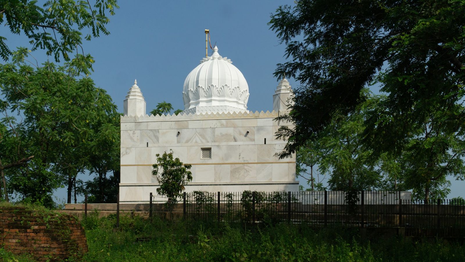
Photo: Sumitsurai, CC BY-SA 4.0 (cropped), via Wikimedia Commons

Ratnagiri hill above Rajgir in early winter, the ropeway cabins climbing towards a white stupa on the ridge.
Bihar has no hill station, but its low, rocky hills hold some of the oldest stories in India.
Rajgir: five hills round an old capital
Bihar has no hill station in the usual sense. The state is the wide plain of the Ganges, with only low hills at its edges, and old lists that called Bodh Gaya, Nalanda or Madhubani hill stations were wrong. The nearest thing is Rajgir, the first capital of Magadha, in a valley ringed by five rocky hills: Vipulachal, Ratnagiri, Udaygiri, Sonagiri and Vaibhargiri.
On Ratnagiri, at about 400 m, stands the white Vishwa Shanti Stupa, the peace pagoda. A ropeway climbs to it in eight-seat cabins from 10 am to 4 pm. Below, a stone path climbs to Gridhakuta, Vulture Peak, where the Buddha is said to have preached. Between Vaibhargiri and Sonagiri, the Rajgir Nature Safari has a glass bridge above the forest. Rajgir has a railway station, and the nearest airports are Gaya and Patna.
Gaya's hills, Barabar and Gurpa
Gaya is ringed on three sides by small rocky hills, climbed by pilgrims for pind daan, the offerings made for the dead. At Pretshila, 676 stone steps lead up to a temple of Yama, the god of death, built by Ahilyabai Holkar of Indore in 1787. Brahmayoni, on the south side of town, has a small temple, two caves and a wide view over the city.
The Barabar hills lie about 35 km north of Gaya, in Jehanabad district. Cut into their granite are polished caves of the Mauryan age, made for ascetics of the Ajivika sect. Gurpa, east of Gaya near the Jharkhand border, is wilder. Buddhists know it as Kukkutapada, where the Buddha's disciple Mahakashyapa is said to wait for the next Buddha. The path climbs through a narrow cleft in the rock: take a torch and a local guide.
The Kaimur plateau
In the south-west, the Kaimur hills rise as a flat-topped plateau. Much of it is the Kaimur Wildlife Sanctuary, the largest in Bihar. It has in-principle approval to become Bihar's second tiger reserve, but had not been notified by October 2026.
The plateau is known for its waterfalls. Telhar Kund, 32 km from Bhabua, drops about 80 m into a pool. Karkatgarh, near the Uttar Pradesh border, is a broad fall about 100 ft high and 300 ft wide, once a crocodile-hunting ground for Mughal and British officials. Both are fullest in and just after the monsoon. The nearest station is Mohania (Bhabua Road); the nearest airport is Varanasi.
Valmiki and the Shivalik foothills
In the far north-west, on the Nepal border, Bihar touches the outermost foothills of the Himalaya. The Valmiki Tiger Reserve, the state's only tiger reserve, covers about 899 sq km of sal forest and low hills in West Champaran, and joins Chitwan National Park in Nepal. Its top, Someshwar, at about 880 m, is the highest point in Bihar, a 14 km walk from the base camp to a Kali temple.
Safaris stop for the monsoon; in 2026 they were due to restart on 16 October. Jeeps go out morning and afternoon, booked online, with none on Tuesdays. Valmikinagar, by the Gandak barrage, is the main base. The nearest stations are Bagaha and Narkatiaganj, and the nearest airports Gorakhpur and Kushinagar.
Mandar Hill and the east
In Banka district, about 50 km from Bhagalpur, a single granite hill of about 800 ft rises from the fields at Bounsi. This is Mandar, which Hindu legend says the gods used to churn the ocean for the nectar of immortality, with the serpent Vasuki as the rope; a groove round the rock is shown as the mark of its coils. Jains revere it too.
The climb on foot takes about an hour. Since 2021 a cabin ropeway reaches the top in about four minutes; check its hours before you go. Bhagalpur is the base.
Hills to know
- Ratnagiri (Nalanda, height about 400 m): the peace pagoda, by ropeway or steps.
- Gridhakuta (Nalanda): Vulture Peak, the Buddha's retreat above Rajgir.
- Pretshila (Gaya): 676 steps to a temple of Yama.
- Brahmayoni (Gaya): a temple hill with caves and city views.
- Barabar hills (Jehanabad): Mauryan rock-cut caves and a hilltop Shiva temple.
- Gurpa (Gaya): a steep Buddhist pilgrim hill.
- Telhar Kund (Kaimur, a fall of about 80 m): the plateau's best-known waterfall.
- Karkatgarh (Kaimur): a wide waterfall in the sanctuary.
- Someshwar (West Champaran, height about 880 m): the highest point in Bihar.
- Mandar Hill (Banka, about 240 m high): a granite hill of legend, with a ropeway.
From the stupa on Ratnagiri the plain runs flat to every horizon, and the hills sit in it like islands.
Plan your visit
| Best season | October to March; April to June is too hot for climbing. The Kaimur falls are fullest from July to October. Valmiki's safaris close for the monsoon (29 June to 16 October in 2026). |
|---|---|
| How to reach | Gaya and Patna airports, and Rajgir and Gaya stations; Mohania station for Kaimur; Bagaha or Narkatiaganj station for Valmiki; Bhagalpur for Mandar. |
| Getting around | A hired car, since the hills lie far apart; autos inside Rajgir and Gaya. |
| Permits and fees | Rajgir ropeway ₹120 Indian, ₹250 foreign. Nature Safari with glass bridge ₹300 (₹150 for children aged 2 to 6), 7 am to 3 pm, online only. Valmiki safaris 6 to 10 am and 2 to 6 pm, booked online. Prices as of October 2026. |
| Where to stay | Rajgir town; Gaya or Bodh Gaya for the Gaya hills, Barabar and Gurpa; Bhabua or Sasaram for Kaimur; Valmikinagar for the tiger reserve. See also Bihar's cities. |
| How long to spend | A day each for Rajgir, the Gaya hills and the Kaimur falls, and two nights at Valmikinagar. More in our Bihar guide. |
Questions people ask
Does Bihar have a hill station?
No. Rajgir's hills, the Kaimur plateau and the Valmiki foothills give views, forest and waterfalls, but none is a cool hill town. For that, go to Darjeeling in West Bengal or Netarhat in Jharkhand.
Is the Rajgir glass bridge open?
Yes, as part of the Rajgir Nature Safari, with tickets online only. Children under six or under 4 ft are not allowed on it, and the safari is closed on 20 October 2026 for Vijayadashami.
When does the Valmiki Tiger Reserve open in 2026?
Safaris were closed for the monsoon from 29 June and were due to restart on 16 October 2026. There are no safaris on Tuesdays.
What is the highest point in Bihar?
Someshwar, at about 880 m (2,884 ft), on the Nepal border in the Valmiki Tiger Reserve.
Read next
Written by Muthu, editor of Aura of India. Sources: Bihar Tourism: Vishwa Shanti Stupa, Rajgir, BSTDC: Rajgir Ropeway (timings and ticket prices), Rajgir Safari, Government of Bihar: Nature Safari, Bihar Tourism: Gridhakut Hill, Bihar Tourism: Pretshila, District Jehanabad: Barabar Caves, Bihar Tourism: Gurpa Hill, District Kaimur: Telhar Waterfall, Bihar Tourism: Karakatgarh, Valmiki Tiger Reserve: Online booking and monsoon closure, National Tiger Conservation Authority: Tiger reserves, Bihar Tourism: Mandar Hill. Last verified: 15 October 2026.
Your turn: Have you climbed to the stupa at Rajgir or up Pretshila? Which hill would you send a friend to first?
Comments
Post a Comment
Comments are always welcome, that will help us to motivate ourselves and improve our services. Thanks!!