Uttarakhand Travel Guide: Char Dham, Hill Towns and How to Reach
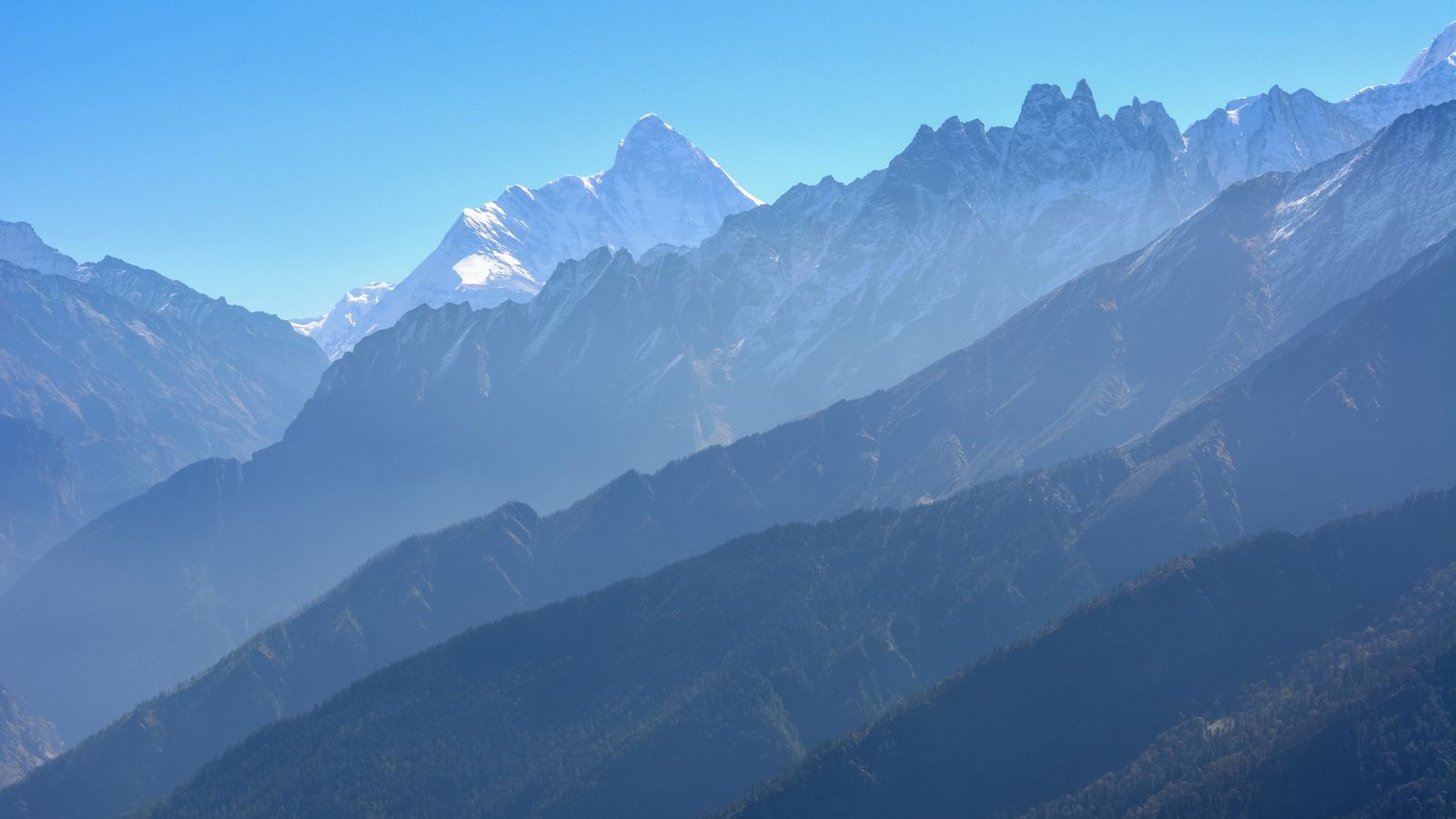
Photo: Ashwani Kumar, CC BY-SA 4.0 (cropped), via Wikimedia Commons

Uttarakhand runs from the Ganga plains at Haridwar to glaciers on the Tibet border. It has two hill regions: Garhwal in the west, with the four Char Dham shrines, and Kumaon in the east, with lake towns and old hill bazaars. Travellers come for pilgrimage, treks, tiger country at Corbett and cool summers in the hills.
This is where the Ganga leaves the mountains, and where pilgrims climb to meet it.
Where to go
- Rishikesh: yoga ashrams on both banks of the Ganga, the evening aarti at Triveni Ghat, and rafting on the river upstream.
- Haridwar: Har ki Pauri, where the Ganga enters the plains and the evening aarti draws thousands every day.
- The Char Dham: Yamunotri, Gangotri, Kedarnath and Badrinath, four high shrines open from late April or May until about November. Kedarnath and Yamunotri are reached on foot or by pony.
- Valley of Flowers and Hemkund Sahib: alpine meadows above Ghangaria, a UNESCO World Heritage site open from 1 June to 31 October, with the Sikh shrine of Hemkund on a lake above.
- Jim Corbett National Park: India's first national park, set up in 1936, with sal forest, grassland and tigers. Some zones open all year; Dhikala opens from 15 November to 15 June.
- Nainital: a lake town in Kumaon, and a base for Bhimtal, Sattal and the orchards of Mukteshwar.
- Mussoorie and Landour: the classic Garhwal hill station above Dehradun, with Landour's quiet lanes and old church.
- Chopta and Tungnath: a short, steep walk to Tungnath, one of the highest Shiva temples, and on to the viewpoint of Chandrashila.
- Almora and Binsar: an old Kumaoni town of stone houses, and a forest sanctuary with long views of the snow peaks.
Main cities
Dehradun is the capital. Bhararisain, near Gairsain in Chamoli district, was declared the summer capital in 2020 and holds some sessions of the assembly. Most visitors pass through the cities on the way to the hills.
- Dehradun: a wide valley town with the Forest Research Institute, and the start of the road up to Mussoorie.
- Haridwar: the pilgrim city of the ghats and a rail junction for the Char Dham road.
- Rishikesh: yoga, rafting and the last town on the plains before the shrine roads climb.
- Haldwani and Kathgodam: the gateway to Kumaon; Kathgodam station is the railhead for Nainital.
- Nainital: the lake, the Mall, and the seat of the state's High Court.
- Mussoorie: walks along the Mall and the Camel's Back road above the Doon valley.
- Almora: the old Lal Bazaar, Kumaoni food and sweets, and temples on the ridge.
- Rudrapur: an industrial town in the Terai plains, close to Pantnagar airport.
- Pithoragarh: the base for Munsiyari and for the long road to Dharchula and Adi Kailash.
For the thirteen districts and how Garhwal and Kumaon divide, read Uttarakhand, Garhwal and Kumaon. To the west lies Himachal Pradesh.
Festivals
- Ardh Kumbh, Haridwar (14 January to 20 April 2027): ten main bathing days, including Maha Shivratri on 6 March and Mesh Sankranti on 14 April.
- Uttarayani Mela, Bageshwar (January, on Makar Sankranti): a fair where the Saryu and Gomti rivers meet.
- Phool Dei (March): on the first day of the month of Chaitra, children leave flowers and rice on every doorstep.
- Ganga Dussehra (May or June): bathing at Haridwar and Rishikesh to mark the descent of the Ganga.
- Nanda Devi Mela (August or September): processions for the mountain goddess in Almora and Nainital.
Regional calendars can shift these dates by a day; check before you go.
Food to try
- Kafuli: spinach and fenugreek leaves cooked into a thick green gravy, eaten with rice.
- Aloo ke gutke: boiled potatoes tossed with chilli, cumin and coriander, a Kumaoni snack.
- Bhatt ki churkani: a dark curry of black soybeans, cooked in an iron pan.
- Mandua roti: flatbread of finger millet, often with ghee and jaggery.
- Jhangora ki kheer: a pudding of barnyard millet cooked in milk.
- Bal mithai: Almora's brown milk fudge, coated in tiny white sugar balls.
Stories from Uttarakhand
- Uttarakhand by District: Haridwar, Char Dham, Nainital, Corbett
- Cities in Uttarakhand: Dehradun, Haridwar, Rishikesh, Haldwani
Plan your visit
| Best season | March to June and September to November for the hills. The Char Dham shrines open from late April or May until about November (in 2026, Kedarnath from 22 April to 11 November). Corbett's Dhikala zone opens 15 November to 15 June. The Valley of Flowers blooms in July and August, which is also the monsoon. |
|---|---|
| How to reach | Jolly Grant airport at Dehradun serves Garhwal and Rishikesh; Pantnagar airport serves Kumaon. Railheads: Dehradun, Haridwar, Yog Nagari Rishikesh, Kotdwar, Kathgodam for Nainital, and Ramnagar for Corbett. Good roads link Delhi with Haridwar, Dehradun and Haldwani. |
| Getting around | State buses, shared jeeps and hired taxis. Char Dham taxis usually start from Haridwar, Rishikesh or Dehradun. Mountain roads close after landslides in the monsoon, so keep a spare day. |
| Where to stay | Tapovan in Rishikesh, near Har ki Pauri in Haridwar, Mussoorie or Landour, Nainital or Bhimtal, Ramnagar for Corbett, Guptkashi or Sonprayag for Kedarnath, and Ghangaria for the Valley of Flowers. |
| How long to spend | Three or four days for Rishikesh and Haridwar; ten to twelve days for all four Char Dham by road; four or five days for Nainital, Almora and the Kumaon hills. |
| Permits | Free online registration on registrationandtouristcare.uk.gov.in is compulsory for Char Dham and Hemkund Sahib pilgrims and their vehicles, with checks at each shrine. Corbett safaris and forest stays are booked on corbettgov.org. Adi Kailash and Om Parvat need an Inner Line Permit from Pithoragarh district for travel beyond Chiyalekh; foreign nationals are not normally allowed there, so check before you go. |
Questions people ask
Is registration compulsory for the Char Dham Yatra?
Yes. Every pilgrim and vehicle must register, free of charge, on the state portal or the Tourist Care Uttarakhand app before setting out. Carry the registration letter with its QR code and verify it at each shrine.
How many days do I need for the Char Dham?
Allow ten to twelve days for all four shrines by road from Haridwar or Rishikesh. Kedarnath and Yamunotri each need a day on foot or by pony, and weather can add more.
Is it safe to visit Uttarakhand in the monsoon?
July and August bring heavy rain, and landslides often block the shrine roads for hours or days. If you travel then, keep spare days, start early and check road status each morning.
How do I reach Nainital?
Take a train to Kathgodam, about 35 km below Nainital, then a taxi or bus up the hill. The nearest airport is Pantnagar, about 70 km away.
When is the best time to see the Valley of Flowers?
The park is open from 1 June to 31 October. Most flowers bloom in July and August, during the monsoon; September is drier with fewer flowers.
Written by Muthu, editor of Aura of India. Sources: Uttarakhand Tourism Development Board: Char Dham and Hemkund Sahib registration portal, Corbett Tiger Reserve: official website, zones and seasons, District Administration Pithoragarh: Inner Line Permit portal. Last verified: 13 October 2026.
Your turn: Have you walked to Kedarnath or Tungnath? Which month did you go, and how was the weather on the trail?
Comments
Post a Comment
Comments are always welcome, that will help us to motivate ourselves and improve our services. Thanks!!