Kerala Itinerary: Coast, Backwaters and the Munnar Tea Hills
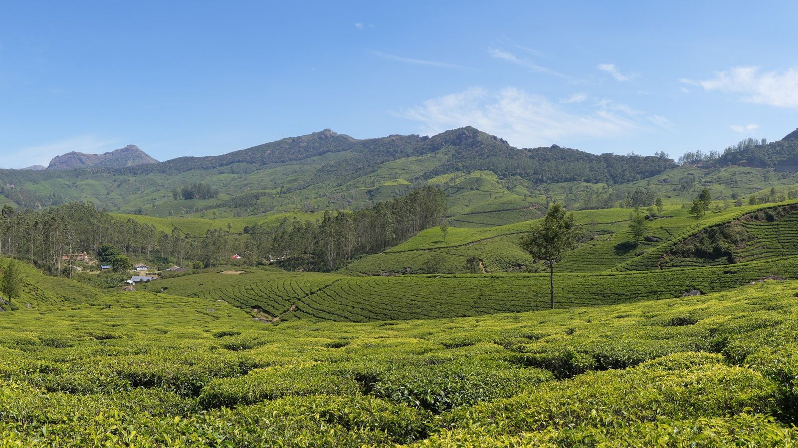
Photo: Ingo Mehling, CC BY-SA 4.0 (cropped), via Wikimedia Commons

Kerala, from the sea to the tea hills, after the monsoon.
Three climates in a single day’s drive.
A narrow green state
Kerala is a thin strip along India’s south-west coast, nowhere much more than 120 kilometres wide. On one side is the Arabian Sea. On the other are the Western Ghats, the mountain range that catches the monsoon and keeps the state so green. In between lie the backwaters. In one day you can drive from a beach, past rice fields and palms, up hairpin bends into cloud and tea.
The coast, the water, the hills
On the coast, Varkala sits on red cliffs above the sea, and Fort Kochi keeps its Chinese fishing nets, great wooden levers lowered into the harbour at dawn. Inland, the backwaters move at the speed of a boat. In the hills, Munnar is tea country at about 1,600 metres, estates cut into dark green terraces, and Thekkady, by the Periyar reserve, is spice gardens and forest. Wayanad, in the north, is coffee and hills.
Why people come
The state’s tourism slogan, God’s Own Country, has lasted because the landscape backs it up. Spices brought traders here for more than two thousand years: Arabs, Romans and Chinese, then the Portuguese, the Dutch and the British. Kerala is also a home of Ayurveda, India’s traditional medicine, and many visitors from abroad come for its treatments. Families from the rest of India come for the cool hills in summer and the green after the rains.
How to cross it
Kochi and Thiruvananthapuram have international airports with many flights from the Gulf, and Kozhikode serves the north. Trains run the length of the coast. From Kochi, Munnar is about three to four hours by road, and Thekkady about five. Hill roads are slow, so go coast, then water, then hills, and let the journey climb.
A ten-day route
Fly into Thiruvananthapuram and go north to Varkala for two nights on the cliffs. Take the train up the coast to Alappuzha for a night on the backwaters, or the public ferry across Vembanad to Kottayam. From Kottayam the road climbs to Kumily and Thekkady, about 110 kilometres and four hours. Stay two nights for the Periyar Tiger Reserve and the spice gardens.
Thekkady to Munnar is about 106 kilometres, another four hours of bends through cardamom and tea. Give Munnar two nights. Then drop down to Kochi, about three hours to the airport, and end with two nights in Fort Kochi and Mattancherry, close to the harbour and the fishing nets. Fly out from Kochi.
The hills: Munnar and Thekkady
Munnar sits at about 1,600 metres in Idukki district, a former British hill resort surrounded by tea estates. The temperature here averages about seventeen degrees. Eravikulam National Park, just outside the town, is home to the Nilgiri tahr, a wild mountain goat found only in these hills. Top Station, on the Tamil Nadu border, looks east over the plains.
Thekkady lies between 900 and 1,800 metres on the Kerala–Tamil Nadu border, next to the Periyar Tiger Reserve. The two names are often used for the same place. Boat trips on the Periyar lake, forest walks and spice-garden visits are the usual way in. Both hill towns are colder than the coast at night. For the rest of the state, district by district, see Kerala's fourteen districts and the Kerala guide.
Before you go
- October is green after the monsoon. December to February is driest.
- Take a jacket for Munnar. Nights are cold even when the coast is warm.
- Tea estates are private land. Book estate walks through your hotel.
- Hill roads can close in heavy rain. Keep a spare day.
The state is the change in the air between those three heights: salt, then water, then cloud.
Plan your visit
| Best season | October to March. December to February is driest. The south-west monsoon runs from June to about September, when hill roads can close. |
|---|---|
| How to reach | International airports at Thiruvananthapuram, Kochi, Kozhikode and Kannur. Trains run the length of the coast. |
| Getting around | Trains on the coast; a car with a driver for the hills. Kottayam to Kumily about 110 km (four hours); Thekkady to Munnar about 106 km (four hours); Kochi airport to Munnar about three hours. |
| Where to stay | Varkala's north cliff; Alappuzha or Kumarakom for the backwaters; Kumily for Thekkady; Munnar town or the estate villages around it; Fort Kochi and Mattancherry. |
| How long to spend | Ten days for coast, backwaters and hills; two weeks to add Wayanad or the north. |
Questions people ask
What is the best month to visit Kerala?
October to March. October is green after the monsoon; December to February is the driest and busiest.
How far is Munnar from Kochi?
About 108 kilometres from Kochi airport, roughly three hours by road along NH85, according to Kerala Tourism. Allow longer from Fort Kochi.
How far is Thekkady from Kochi?
About 190 kilometres from Kochi airport, usually five hours or more. Madurai airport, about 140 kilometres away, is closer.
Is Munnar cold?
Cool rather than cold: Kerala Tourism gives an average of about 17°C. Nights can be chilly from December to February, so bring a warm layer.
Read next
Written by Muthu, editor of Aura of India. Sources: Kerala Tourism: How far is Munnar from Kochi airport?, Idukki District, Government of Kerala: How to reach, Kerala Tourism: Thekkady. Last verified: 13 October 2026.
Your turn: Which part of Kerala surprised you most: the coast, the water or the hills?
Comments
Post a Comment
Comments are always welcome, that will help us to motivate ourselves and improve our services. Thanks!!